The map below displays the Yellowstone River Basin and its four major subregions: Upper Yellowstone (HUC 4-1007), Big Horn (HUC 4-1008), Power-Tongue (HUC 4-1009), and Lower Yellowstone (HUC 4-1010). The map includes a Flood Hazard Area layer (last updated on Nov. 13, 2019) which indicates floodplain hazard zones within the basin. Interact with this map (zoom and click) to locate floodplain data such as areas with 1% annual chance of flood hazard, regulatory floodways, and more. Expand the map details ( >> ) for legend.
View larger map
Since the YRB is so expansive, I decided to take a closer look at floodplain and alluvial soil data in the most populated county in the basin: Yellowstone County, MT.
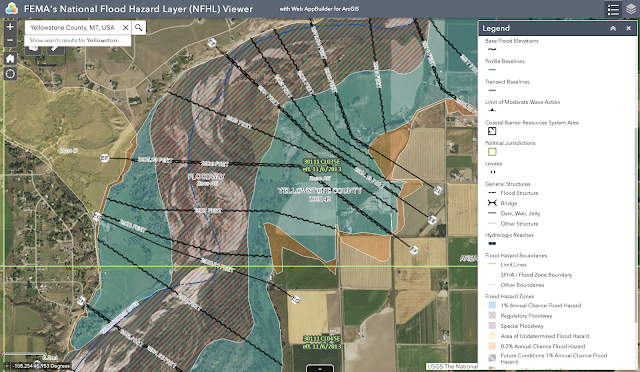
FEMA's National Flood Hazard Layer (NFHL) Viewer is a great place to start for floodplain information:
Another is the FEMA Flood Map Service Center which also includes links and other tools for the area of interest.
For soil data, I used the USDA's Web Soil Survey (WSS) and set the Yellowstone County, MT Soil Survey Area as my area of interest (AOI).
Agriculture (including livestock) is one of the dominant industries within the Yellowstone River Basin and Yellowstone County, MT. Main products are grain, sugar beets, sheep, and cattle, so I used the Soil Data Explorer tab to determine whether or not the region's soils are conducive to this industry. I looked at farmland classification, rangeland seeding potential in the Colorado Plateau ecoregion, irrigation potential, and surface water management ratings. Here's what I found:
Much of Yellowstone County Soil Survey Area is not prime farmland.
The soil is more capable of supporting livestock than crops, but both are still highly dependent on irrigation potential.
Finally, I looked at soil ratings as they relate to surface water management. It turns out that much of Yellowstone County is very limited. Overall, I would say that soils in this region do not support agriculture as a dominant land use.
Resource
United States Department of Agriculture Natural Resources Conservation Service. (2019, April 9). Web Soil Survey Home. Retrieved from https://websoilsurvey.sc.egov.usda.gov/App/HomePage.htm.


Comments
Post a Comment